Cerro Bandera, está situado a 6 kilómetros del ingreso a Luján, en la costa del dique.Desde este imponente cerro de 1550 metros sobre el nivel del mar, se aprecia un incomparable paisaje, en primer plano, de todo el embalse y los grandes cerros que lo encajonan.Situado a 200 metros de altura del río Luján, se deja ver al fondo la gran llanura del Oeste de la Provincia de San Luis.
Cerro Bandera, is located 6 kilometers from the entrance to Lujan, on the shore of the dam. From this imposing hill of 1550 meters above sea level, there is an incomparable landscape, in the foreground, around the reservoir and large hills that encasing. Located at 200 meters high river Lujan gets to see the substance of the great plains west of the Province of San Luis

Este embalse está construído en 1958 sobre el río Luján, formado por la unión de los ríos San Lorenzo y Las Palmitas, cuenta con una superficie de 27 hectáreas, cuyo caudal medio es de 0.380 m3/s.
Su costa es escarpada, sólo hay un sector donde se puede acceder a través de un pequeño terreno de 6 x 30m, que se le ha ganado al dique.
Su costa es escarpada, sólo hay un sector donde se puede acceder a través de un pequeño terreno de 6 x 30m, que se le ha ganado al dique.
Posee poca utilización recreativa, ya que por sus características, darse baños es peligroso. El sector utilizable es la cola del dique, que conforma una pequeña playa, a la que se accede atravesando el dique en balsa.
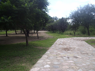
La vegetación representada en los alrededores del embalse con molles, talas, algarrobos, chañares, entre otros.
Posee una perspectiva visual totalmente cerrada, ya que se ubica en un recodo del río Luján y se encuentra rodeado por grandes cerros como el Independencia y el Bandera, que ofician además de refugio de cóndores.
This reservoir was built in 1958 on the river Lujan, formed by the union of the St. Lawrence rivers and Las Palmitas, has an area of 27 hectares, whose average flow is 0,380 m3 / s. Its coastline is rugged, there is only one sector where it can be accessed through a small field of 6 x 30m, which he has won the dike. It has little recreational use, since by their nature, give baths is dangerous. The sector is usable tail dam, which forms a small beach, which is accessed through the dam raft. The vegetation represented in the vicinity of the reservoir with molles, logging, carob, chañares, among others. It has a visual perspective completely closed since it is located on a bend of the Lujan, it is surrounded by large hills as the Independence and the flag, who function well as a haven for condors


No hay comentarios.:
Publicar un comentario